- 2:14 h
- 7.53 km
- 157 m
- 276 m
- 143 m
- 276 m
- 133 m
- Start: Hiking parking lots "Schneegrund" or "Am Vorberg"
- Destination: Hiking parking lots "Schneegrund" or "Am Vorberg"
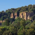
A sign at the Schneegrund hiking parking lot points to a stone cist grave, probably 45 m long and 2 m wide, which is possibly one of the most important large stone graves in Western Europe. The cultural journey continues via a reference to the western border of the ancient Germanic Thilitigau region on the Amelungsberg and via refuge castles from the time around the birth of Christ to the ancestral castle of one of the numerous dynasts of this region, the Counts of Roden. This was built in the first half of the 12th century. The Amelungsburg is a 300 x 900 m refuge castle on the 312 m high plateau of the mountain, which belonged to a chain of similar fortifications in the Weser region at strategically favorable points and can be dated to the time around the birth of Christ. It probably played a role in the Roman campaigns against the Germanic tribes. The famous Süntel Battle of 782 may also have taken place here. The tour also leads through the Schneegrund valley with the Naturfreundehaus Schneegrund and along the Höllenbach stream. This circular route is not only very interesting from a cultural and historical point of view, but is also very scenic. Most of the trail leads through a nature reserve, so please stay on the paths!
(Source: "Unser Sonntagsausflug Bd.2", Ingeborg Müller, CW Niemeyer)
Route: Wanderparkplatz Schneegrund - Rohdental - Naturfreundehaus - Amelungsberg - Amelungsburg - Höllenbach - Wanderparkplatz Schneegrund
(Source: "Unser Sonntagsausflug Bd.2", Ingeborg Müller, CW Niemeyer)
Route: Wanderparkplatz Schneegrund - Rohdental - Naturfreundehaus - Amelungsberg - Amelungsburg - Höllenbach - Wanderparkplatz Schneegrund
Waypoints
Start
Good to know
Best to visit
suitable
Depends on weather
Directions & Parking facilities
Wanderparkplätze "Schneegrund", "Am Vorberg" oder Waldbad Rohden
Contact person
Zweckverband Touristikzentrum Westliches Weserbergland
Marktplatz 7
31737 Rinteln
Author
Zweckverband Touristikzentrum Westliches Weserbergland
Marktplatz 7
31737 Rinteln
Organization
Zweckverband Touristikzentrum Westliches Weserbergland
License (master data)
Zweckverband Touristikzentrum Westliches Weserbergland
Map
Our recommendations
Nearby
