- 3:22 h
- 12.36 km
- 189 m
- 185 m
- 181 m
- 355 m
- 174 m
- Start: Hiking parking lots Baxmannbaude
- Destination: Hiking parking lots Baxmannbaude
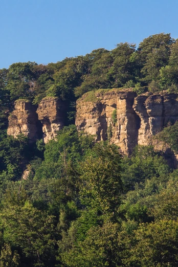
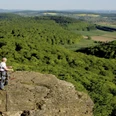
The Hohenstein cliffs in Hessisch Oldendorf are considered one of the highlights of the hiking area in western Weserbergland. Germanic tribes, Cherusci and Saxons once worshipped their gods on this mysterious stone cliff from bygone times. Don't miss the sight of the cliffs plunging 50 meters into the depths, which give you goosebumps when you look down. So better look into the distance and enjoy the magnificent view over the lovely Weser valley. The starting point for this hike is the "Baxmannbaude" parking lot, near which you will also find the Baxmannbaude forest tavern in the Blutbachtal valley.
route: Baxmannbaude - Hohenstein nature reserve - Grüner Altar - Teufelzkanzel - Baxmannbaude
route: Baxmannbaude - Hohenstein nature reserve - Grüner Altar - Teufelzkanzel - Baxmannbaude
Waypoints
Start
Good to know
Best to visit
suitable
Depends on weather
Directions & Parking facilities
Wanderparkplätze Baxmannbaude, Försterlaube oder Langenfeld
Contact person
Zweckverband Touristikzentrum Westliches Weserbergland
Marktplatz 7
31737 Rinteln
Author
Zweckverband Touristikzentrum Westliches Weserbergland
Marktplatz 7
31737 Rinteln
Organization
Zweckverband Touristikzentrum Westliches Weserbergland
License (master data)
Zweckverband Touristikzentrum Westliches Weserbergland
Map
Our recommendations
Nearby
