- 2:14 h
- 7.40 km
- 203 m
- 203 m
- 156 m
- 352 m
- 196 m
- Start: Hiking parking lot Kreuzsteinquelle
- Destination: Hiking parking lot Kreuzsteinquelle
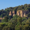
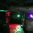
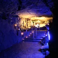
The tour first leads through the sparse forest along the Blutbach stream in the Hohenstein area, one of the most popular destinations in the region. Legend has it that the Blutbach got its name from the fact that it was dyed red by the blood of the warriors during the battle between the Saxons and Franks in 782. The Hohenstein awaits at a height of 330 m with a breathtaking view from the 60 m high cliffs. It was the main shrine of the pagan Saxons. You then reach the Green Altar, also known as the Devil's Pulpit. Cultic acts probably took place here. From here, follow the signs for the Hohenstein circular hiking trail back to the starting point. Keep an eye out for details along the way, such as the cross stone.
route: Kreuzsteinquelle hiking parking lot - Blutbach stream - cliffs of Hohenstein - Green Altar - Devil's Pulpit - Kreuzsteinquelle hiking parking lot
route: Kreuzsteinquelle hiking parking lot - Blutbach stream - cliffs of Hohenstein - Green Altar - Devil's Pulpit - Kreuzsteinquelle hiking parking lot
Waypoints
Start
Good to know
Best to visit
suitable
Depends on weather
Directions & Parking facilities
Wanderparkplatz Kreuzsteinquelle
Contact person
Zweckverband Touristikzentrum Westliches Weserbergland
Marktplatz 7
31737 Rinteln
Author
Zweckverband Touristikzentrum Westliches Weserbergland
Marktplatz 7
31737 Rinteln
Organization
Zweckverband Touristikzentrum Westliches Weserbergland
License (master data)
Zweckverband Touristikzentrum Westliches Weserbergland
Map
Our recommendations
Nearby


